")
")
")
")
")
")
Here is this video impression on Facebook.
- description
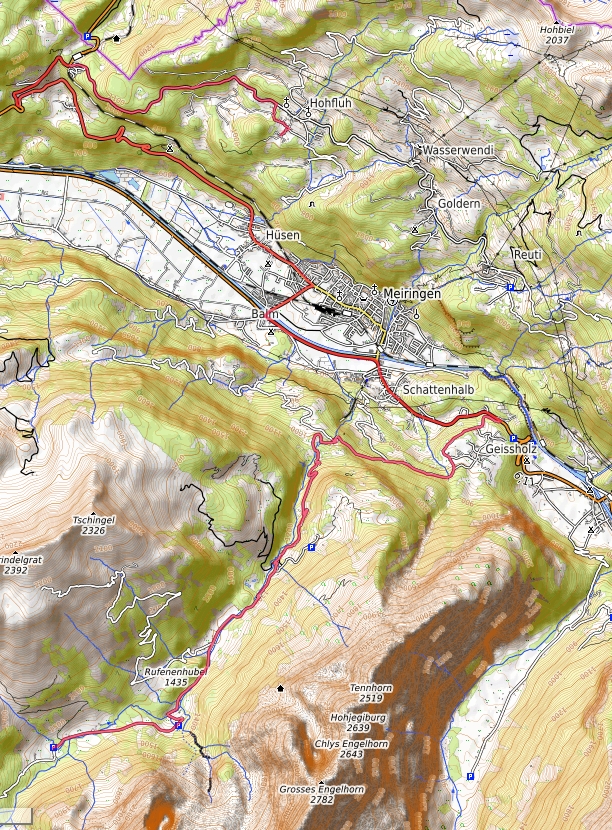
First you drive by car (length 26.4 km one way) from our Hotel Bellevue Hohfluh Hasliberg over the Brünigpass, Meiringen, Lammi over the Postbusstrasse Rosenlaui and up to the Schwarzwaldalp at 1575 meters above sea level.
Please note that from Lammi one or more post buses can come towards you, and that on a very narrow street! It is very worthwhile to find out whether and when a post bus is going in the opposite direction before you travel. This is e.g. B. to find in the timetable of the Bernese Oberland, which you can z. B. in the train station of Meiringen for a small nominal charge.
Please always drive from alternative to alternative. Open your window to see oncoming vehicles early on. Honking does not bother.
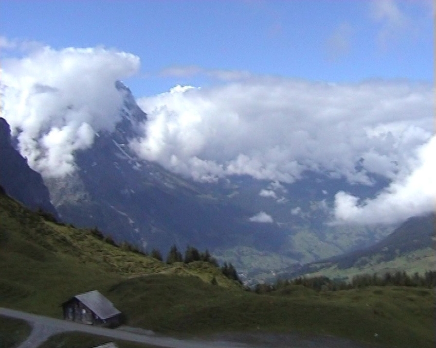
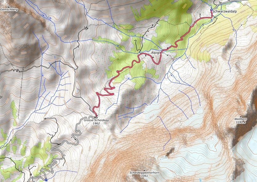
From the Schwarzwaldalp, which is the end of a dead end for cars, the bus continues up to the Grosse Scheidegg, the pass between Meiringen and Grindelwald at an altitude of 1962 meters. In the background you can see the Wetterhorn, Eiger, Jungfrau and Mönch. So here you are in one of the most beautiful hiking areas in Central Switzerland!
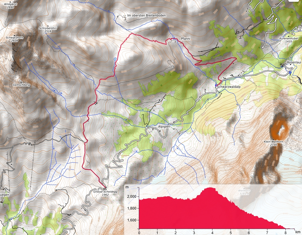
We walk in the direction of travel to the right in the direction of First, but at the first junction we branch right down to the Oberläger. A few steps further it goes steeply up to the Hornseeli at an altitude of about 2100 meters. Behind it you then descend back to the Schwarzwaldalp. The path length is 8.5 km.
Please note that we are here on a mountain path. Perhaps no problem for alpine climbers, but not manageable for pure tourists. From 1980 we always had the opportunity to go hiking in the mountains and only learned such tours after years of hiking. So please don't take any great risks and go back to Schwarzwaldalp from Grosse Scheidegg along a footpath parallel to the Postbus. We used to do that ourselves. I later made a compromise solution over the romantic path with my girlfriend during this tour .
A splendid tour but with an effort.
- Road map
- Postbus card
- hiking map
All maps with their own GPX file as an overlay from https://opentopomap.org/ under the copyright © OpenStreetMap contributors www.openstreetmap.org/copyright :